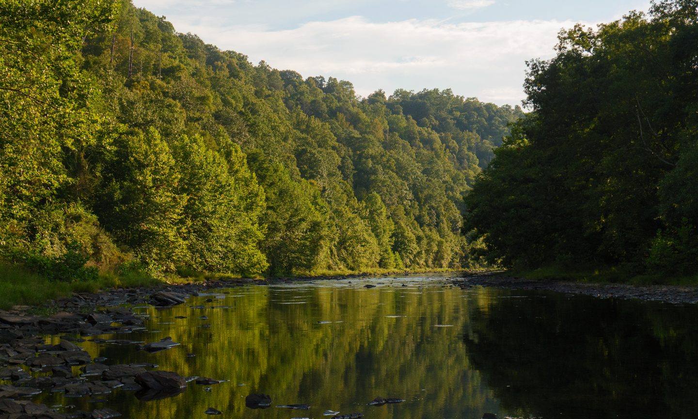
The Greenbrier River Trail spans 78 miles along a former railroad bed through the wild and scenic heart of the Greenbrier Valley. With a gentle consistent grade, well-maintained trail conditions, designated campsites, and several charming small towns along its route, the trail is ideal for a weekend bikepacking adventure. Along its entire length, the trail offers an abundance of the natural splendor and scenery that West Virginia is known for. Whether it’s your first overnighter on a bike, or you’re a backpacking veteran, the GRT is a worthy destination.
Here’s a primer to get you started on bikepacking the GRT
Getting There and Getting Started
The trail runs from Caldwell at the southern end to Cass at the northern end. Both ends offer ample parking, with Caldwell featuring two parking areas, one of which recently opened.
The trail has a slight downhill grade of less than one percent from Cass to Caldwell. It’s not enough to coast on, but it’s worth knowing when planning your direction. If you’re doing a one-way trip, starting in Cass and riding south to Caldwell takes advantage of whatever marginal benefit that grade provides,even if it is merely the psychological placebo of going “dowhnhill”.
Shuttle services are available from most locations, but providers phase in and out. It’s best to confer with the Greenbrier River Trail Facebook group for a pulse on active services.
My recommendation for someone coming from out of town is to consider a complete round trip, which eliminates the shuttle logistics entirely. A base camp approach works well for this and is outlined in the suggested itineraries below.
Trail Conditions
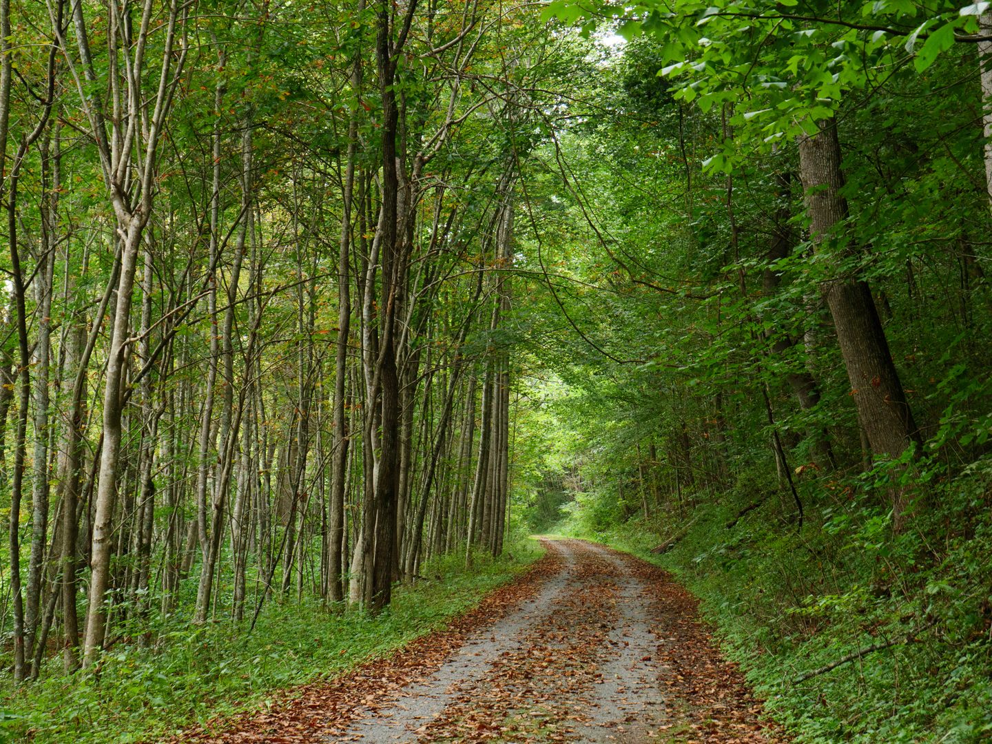
One of the many pleasantries of the GRT is the sheer quality of the ride. With most of the trail surface being quarter-inch crushed limestone, it rides smooth, fast, and stable. It’s well-packed and drains nicely after a rain. Basically, it’s a dream to ride on. Beyond that, the trail is exceptionally well maintained by volunteers and the West Virginia Division of Natural Resources. There is rarely a scrap of litter anywhere to be found.
One section to be aware of: the asphalt stretch through Marlinton is heaving in spots due to tree roots. It’s not dangerous, just something to expect.
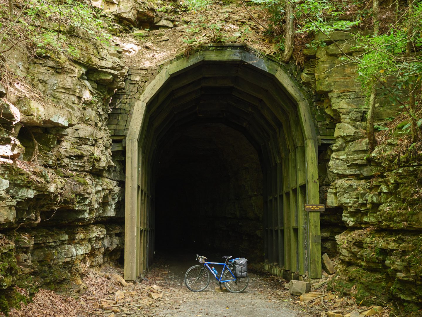
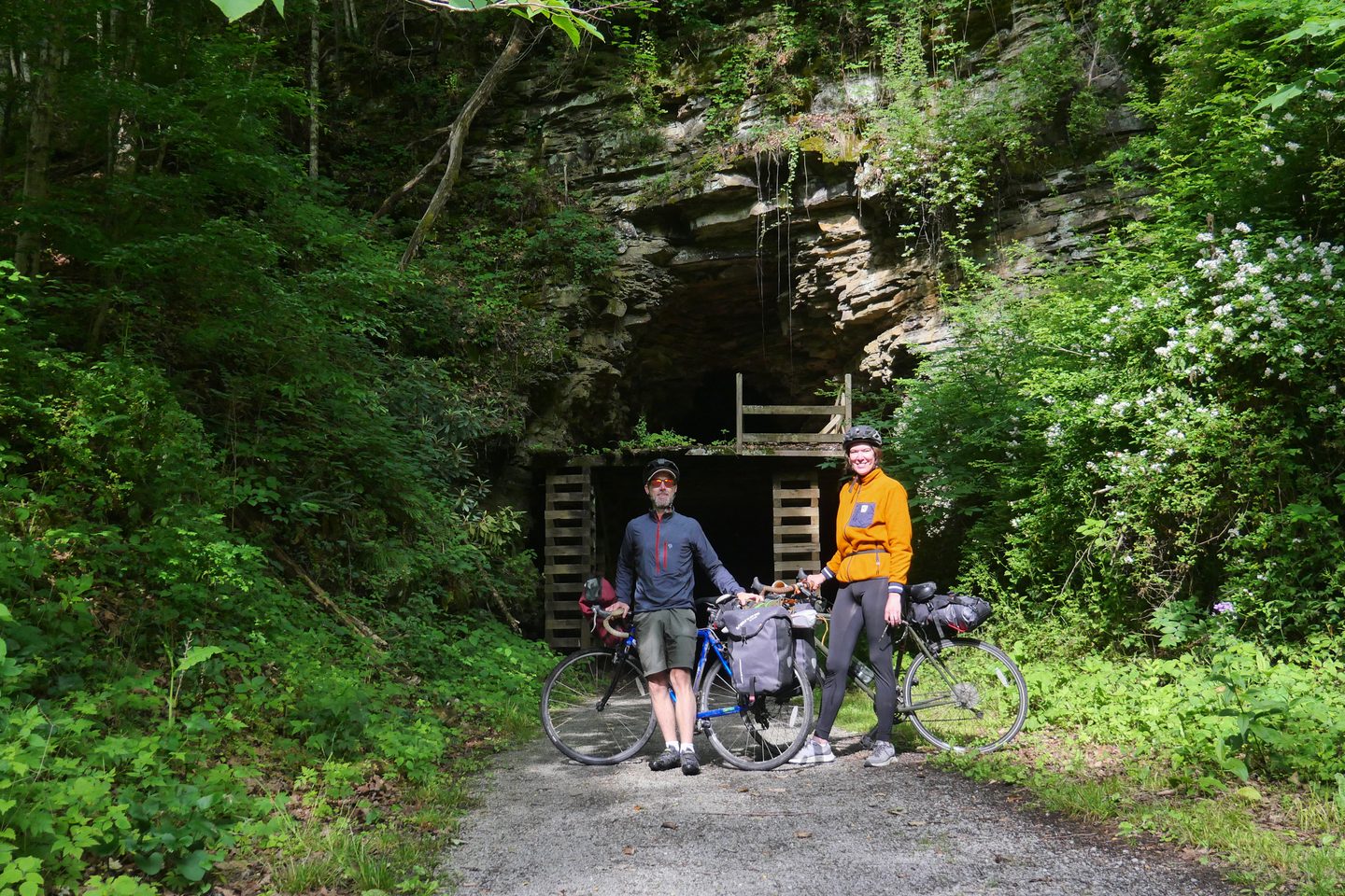
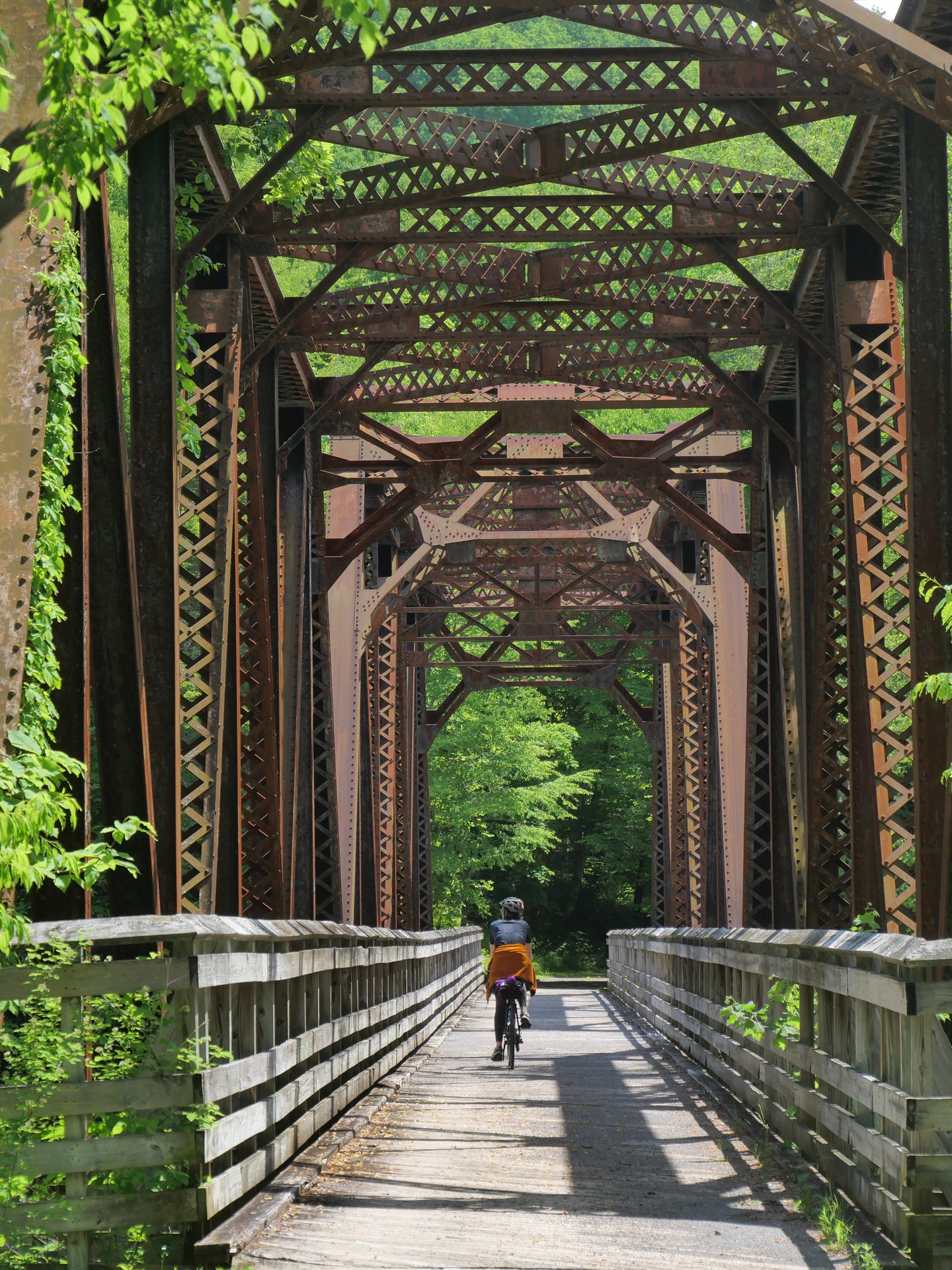
Other notable features to be aware of include numerous trestle bridges and two tunnels that require passage. Some of the bridges can become slick in wet weather so be mindful. The tunnels are not lit so plan to bring a flashlight or walk your bike carefully.
Note: for the next two years the trail is undergoing a significant bridge redecking project. Please check the Greenbrier River Trail website for most up to date trail notices: https://www.greenbrierrivertrail.com/trail-alerts/
Water on the Trail
Multiple water sources are available along the trail. Seasonal hand pumps are located at many of the primitive campsites, though these are often decommissioned during winter months. Potable water is available in the towns, particularly Marlinton, where restaurants and shops will generally allow water bottle refills.
The Greenbrier River itself is not a reliable drinking water source without treatment.Filtering or treating any water sourced from the river is strongly recommended. Plan to carry enough water between towns and confirmed pump sources, especially in the more remote stretches.
Camping Options
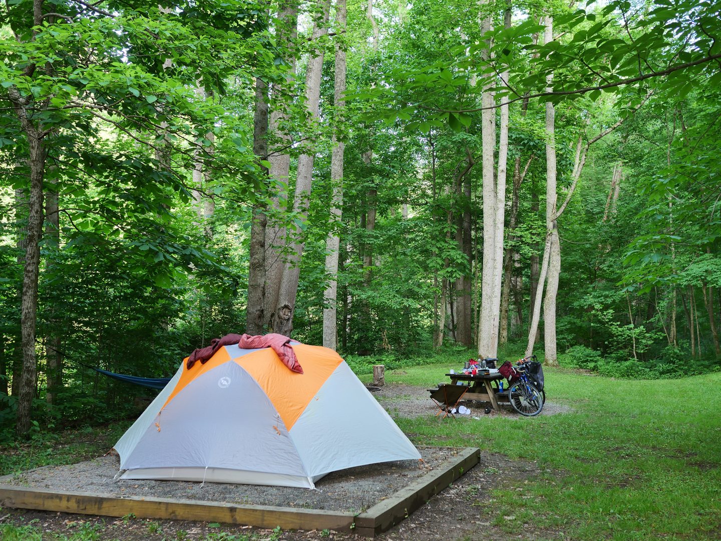
Camping on the GRT is permitted only at the 15 designated campsites along the trail. Each site typically features a fire ring, picnic table, tent pad, and a shelter of some kind. Trash receptacles are available at most sites. With the abundance of trees in the area, hammocking is a solid option as well.
Some sites are in proximity to the river while others are set back from it. All are generally well maintained, consistent with the overall quality of the trail itself.
Campsite availability, in my experience, is not currently an issue on the GRT. The trail does not see the volume of visitors to make competition for sites a concern. I’ve gone bikepacking during some of the busiest times of the year, including Labor Day weekend, and have only encountered a handful of other bikepacking travelers.
Resupply, Food, and Towns
The trail passes through several small communities where you can restock, refuel, and get a feel for life in the Greenbrier Valley.
Caldwell / Lewisburg: Caldwell is the southern terminus and primarily a parking area. The real draw is nearby Lewisburg, just up the hill. A surprisingly cosmopolitan town of 4,000 people that has been named “America’s Coolest Small Town” by Budget Travel Magazine, Lewisburg offers full amenities, a vibrant arts scene, antique and boutiques shopping, and an excellent place to bookend a trip. After finishing a ride, consider a beer on the lively patio at the Briergarten (impressive selection of local and import beer on tap) or stone fired pizza at the local favorite Hill and Holler.
Seebert: Home to Jack Horner’s Corner, a trailside convenience store and small cafe (soft serve ice cream, pizza, burgers, etc.) with a surprisingly large selection of bike equipment. It serves as roughly the midpoint oasis and a great place to restock/refuel. Seebert is also situated near the entrance to Watoga State Park, the largest state park in West Virginia at over 10,000 acres, which is also a viable place to camp with reservations.
Marlinton: The river trail goes straight through the heart of this small town, which was recently designated as a National IMBA Trail Town for its epic Monday Lick MTB trail system. Food options include the Dairy Land for a quick hamburger and milkshake, Rivertown Cafe for more artisan, handmade fare in a charismatic vintage building, and the Greenbrier Grill for outdoor seating overlooking the river and massively portioned greasy-spoon food. (pro top: don’t finish a complete biscuit and gravy breakfast platter and expect to feel comfortable on your bike afterwards). Check out Grennbrier Bikes for a full-service and well-appointed bike shop staffed with knowledgeable people. Don’t miss the Saturday morning farmer’s market if your timing lines up, and check out the impressive array of local art upstairs at the cafe. The town is also home to the Pocahontas County Opera House, and if your trip falls on a First Friday, you may find a band in the pavilion, and, if you are lucky, a sighting of Sasquatch.
Cass: The northern terminus is a historic logging town preserved in time. Food options are more limited here: two small cafes, a general store, and park infrastructure. But Cass is worth more than a quick stop. The Cass Scenic Railroad State Park features the restored steam locomotive, and the town’s well-preserved company houses, museum, local art gallery by the train station, and remnants of a once-bustling mill give it real character. Arrive early or linger if you can.
Plan to be self-sufficient between these stops, particularly on the more remote stretches north and south of Marlinton.
Cell Service
Cellular service is unavailable for most of the trail, as it falls within the National Radio Quiet Zone. There is intermittent service roughly between mile 3 and mile 25, and in and around Marlinton. Beyond that, expect to be disconnected.
Plan accordingly. Coordinate with anyone who needs to know your whereabouts before you head out. Carry a reliable repair kit and the tools to fix a flat. Do not count on being able to call for help from the trail.
Most importantly, relish in the complete joy and abandon of being disconnected from internet and phone connection, a rare commodity in today’s world.
The FAROUT app is highly recommended. It contains all the information from the trail’s interactive map in an offline format that works without cell service.
Gear Considerations
Because of the excellent trail conditions, moderate weather, and regular towns along the route, the GRT is remarkably forgiving from a gear perspective. This is not a trail that demands highly specialized equipment or agonizing over your packing list.
Bike Selection
Almost any bike is capable of handling this trail. Gravel, hybrid, and mountain bikes are all well-suited. Road bikes wouldn’t be my first choice, but still possible. Honestly, it’s less about the bike and more about the tires, with modern gravel tires around 40mm offering a sweet spot. With that said, this is not the trail to obsess over gear selection. It’s best to just get out there!
A note on E-Bikes
Class 1 and Class 2 electric bicycles are allowed on the GRT and have the same rights and privileges as traditional bicycles. Be respectful of other trail users and keep your speed in check when passing. Note that there is no dedicated place on the trail to charge e-bikes, so plan your battery accordingly.
Other gear considerations:
Headlamp or bike light: The trail tunnels require a light for safe passage. Do not skip this or you may end up relying on your cell-phone flashlight to stumble through the tunnel.
Flat repair kit and basic bike tools: With limited cell service, self-sufficiency is important.
Water treatment A filter or purification tablets if you plan to draw from the river or are uncertain about pump availability.
Layers: The trail sits low between valley walls and is heavily shaded. It’s noticeably cooler than the surrounding area, particularly in the mornings when fog insulates the deep valley. This is a benefit in summer but worth preparing for on cooler days.
Beyond that, this is one of those trails to come prepared, and be safe, but to not overthink it. As long as you are warm, dry, and comfortable, almost any proper gear setup will suffice. Grab that old child carriage from the garage, pack it full of your dusty old car camping kit, and hit the trail!
Wildlife and Safety
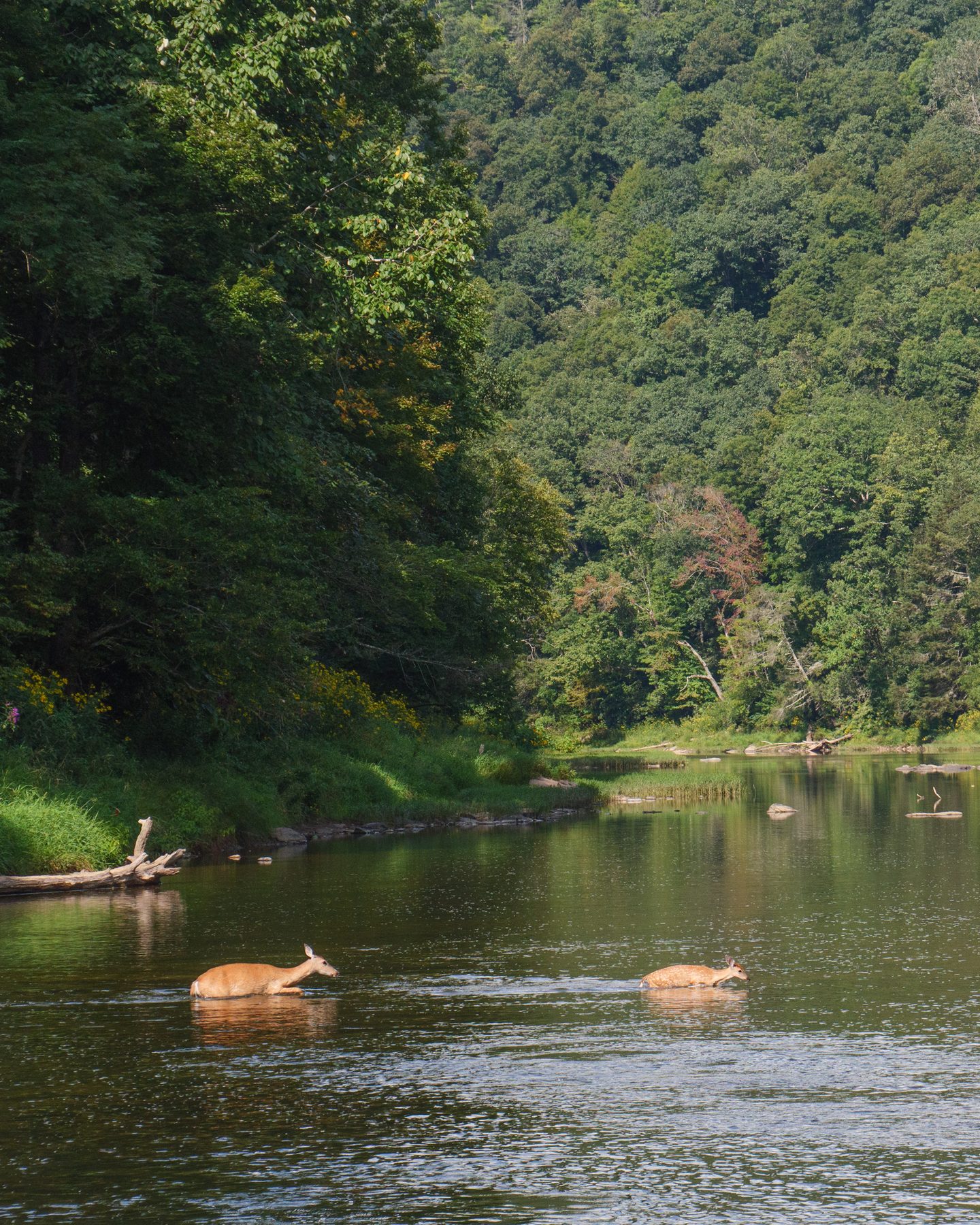
Deer habituate the trail and use it as a corridor. You will see them. Bear are also commonly sighted, though encounters tend to be brief and uneventful. Standard bear awareness applies: store food properly, make noise, and give them space.
Dogs are common on the trail and not always leashed. In four years of regular riding, I have yet to encounter an aggressive dog, but it’s worth being aware of.
Hunting is permitted along the trail during legal open seasons. Uncased firearms are not allowed at other times. If you’re planning a trip during hunting season, wear visible colors and be aware of your surroundings.
Suggested Itineraries
Two-Day One-Way (Cass to Caldwell)
Day one: Start in Cass early in the morning and enjoy the solitude and stillness of those first twenty miles into Marlinton. Spend some time exploring town, grab a coffee, browse the shops, have lunch. Continue south past Seebert to the campsite at mile 41, which features a tent pad, fire ring, picnic table, trash can, and sits beside a small stream. Scenic and cozy.
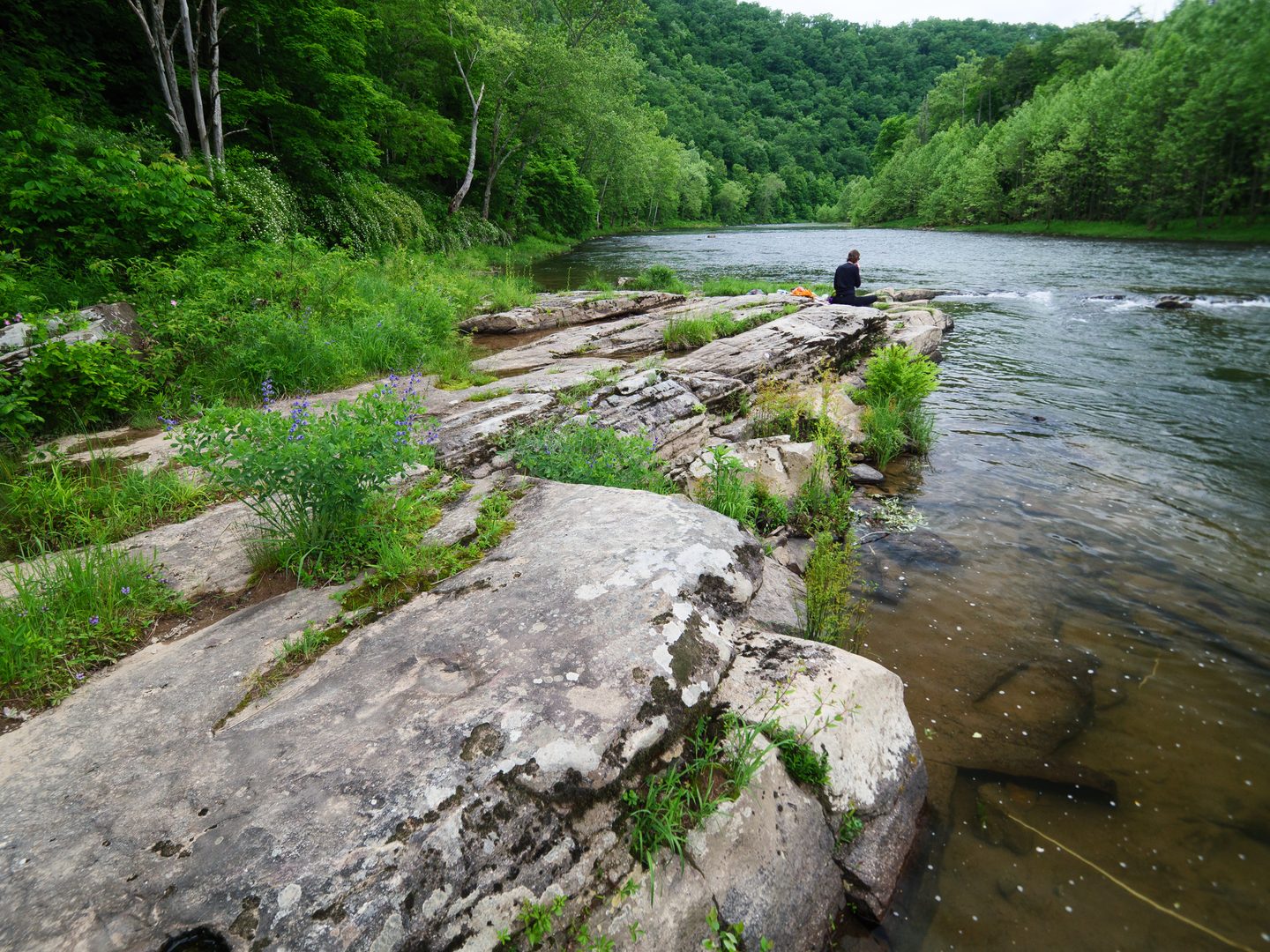
Day two: Early start. Pass through the Droop Mountain tunnel and get your miles in early. Plan for a picnic lunch at the beautiful set of rapids at about mile 15, just north of Anthony, where there are impressive rock formations in the river. Polish off the remaining miles and stop at mile 4.3 for a celebratory dip at the locals’ favorite swimming rock. You’ll be dry before you get back to your car. Head into Lewisburg for a well-earned meal.
Three-Day Round Trip (No Shuttle Needed)
Day one: Start in Caldwell and cycle north to approximately mile 51 to set up a base camp just south of Marlinton, which will be your camp for both nights.
Day two: Wake up and ride into Marlinton for a quick breakfast, unencumbered by all your gear, which you can leave at camp. Cycle freely up to Cass and spend a few hours soaking in the history. Have lunch at one of the cafes, check out the steam locomotive, then head back toward camp, possibly stopping in Marlinton again on the way.
Day three: Enjoy a restful night at camp before the ride back south. Stop at the picnic spot near Anthony for lunch and finish with the river dip at mile 4.3 before rolling into Caldwell.
Note: this three-day itinerary can be shortened by starting further north on day one. While you will miss out on the lower 25 or 30 miles of the trail, it’s all the more reason to come back again.
Best Time to Ride
Anytime from April through mid-October is prime season for bikepacking the GRT. The trail sits in a deep, shaded valley that creates its own microclimate. In the hotter months, less direct sun hits the trail throughout the day, making it considerably cooler than the surrounding area. Many mornings feature a fog effect that insulates the valley from whatever is happening on the plateau above.
Early to mid-October is prime leaf-peeping season and arguably the most visually stunning time to ride the trail.
Trail Etiquette
This is a heavily mixed use trails, with pedestrians, occasional equistrians, and users of all ages and abilities. The trail is heavily trafficked near Marlinton and Caldwwell. Be mindful and be considerate. Cyclists yield to pedestrians, everyone yields to horses. Keep right, pass left, and give a verbal alert or use a bell when passing. Control your speed around other users. Keep pets leashed and clean up after them. Leave no trace and carry out all trash.
Final Word
Whether you’re a seasoned bikepacker, a first-timer looking for a low-key introduction to the sport, a family seeking an adventure, or someone who just wants a relaxing experience on a scenic trail, the GRT can deliver it all. As a world-class trail of its kind, It checks all the boxes: beautiful scenery, a wild river, history, solitude, and welcoming towns. A person just show up, start pedaling, and let this amazing rail trail do the rest.
Resources
– Greenbrier River Trail official website
– Greenbrier River Trail Association (GRTA)
– Greenbrier River Trail Foundation (GRTF)
– WV Division of Natural Resources
– FAROUT App
– Watoga State Park
– Cass Scenic Railroad State Park
– Lewisburg visitor information
About the Author
Mike Renner
Mike Renner is a Greenbrier Valley resident and year-round rider of the GRT. He has bikepacked the t...